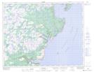
Maps showing Dung Hill Pond, Newfoundland and Labrador
Dung Hill Pond is a Lake located in Newfoundland and Labrador.
- Latitude: 50° 44' 13'' North (decimal: 50.7369000)
- Longitude: 56° 22' 54'' West (decimal: -56.3817000)
- Topography Feature Category: Lake
- Geographical Feature: Pond
- Canadian Province/Territory: Newfoundland and Labrador
- Atlas of Canada Locator Map: Dung Hill Pond
- GPS Coordinate Locator Map: Dung Hill Pond Lat/Long
Dung Hill Pond NTS Map Sheets