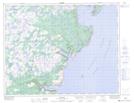
Maps showing Northern Hay Peak, Newfoundland and Labrador
Northern Hay Peak is a Mountain located in Newfoundland and Labrador.
- Latitude: 50° 43' 41'' North (decimal: 50.7280999)
- Longitude: 56° 23' 1'' West (decimal: -56.3836000)
- Topography Feature Category: Mountain
- Geographical Feature: Peak
- Canadian Province/Territory: Newfoundland and Labrador
- Atlas of Canada Locator Map: Northern Hay Peak
- GPS Coordinate Locator Map: Northern Hay Peak Lat/Long
Northern Hay Peak NTS Map Sheets