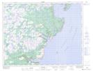
Maps showing Breens Pond, Newfoundland and Labrador
Breens Pond is a Lake located in Newfoundland and Labrador.
- Latitude: 50° 40' 53'' North (decimal: 50.6814000)
- Longitude: 56° 13' 39'' West (decimal: -56.2274999)
- Topography Feature Category: Lake
- Geographical Feature: Pond
- Canadian Province/Territory: Newfoundland and Labrador
- Atlas of Canada Locator Map: Breens Pond
- GPS Coordinate Locator Map: Breens Pond Lat/Long
Breens Pond NTS Map Sheets