Maps showing Pelleys Skirt, Newfoundland and Labrador
Pelleys Skirt is a Forest located in Newfoundland and Labrador.
- Latitude: 50° 44' 28'' North (decimal: 50.7411000)
- Longitude: 56° 32' 58'' West (decimal: -56.5494000)
- Topography Feature Category: Forest
- Geographical Feature: Woods
- Canadian Province/Territory: Newfoundland and Labrador
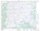
- Atlas of Canada Locator Map: Pelleys Skirt
- GPS Coordinate Locator Map: Pelleys Skirt Lat/Long
Pelleys Skirt NTS Map Sheets