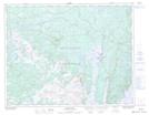
Maps showing High Mesh, Newfoundland and Labrador
High Mesh is a Low vegetation located in Newfoundland and Labrador.
- Latitude: 50° 58' 48'' North (decimal: 50.9799999)
- Longitude: 56° 26' 34'' West (decimal: -56.4427999)
- Topography Feature Category: Low vegetation
- Geographical Feature: Marsh
- Canadian Province/Territory: Newfoundland and Labrador
- Atlas of Canada Locator Map: High Mesh
- GPS Coordinate Locator Map: High Mesh Lat/Long
High Mesh NTS Map Sheets