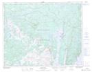
Maps showing Charlie Busheys Ponds, Newfoundland and Labrador
Charlie Busheys Ponds is a Lake located in Newfoundland and Labrador.
- Latitude: 50° 50' 39'' North (decimal: 50.8441999)
- Longitude: 56° 19' 41'' West (decimal: -56.3280999)
- Topography Feature Category: Lake
- Geographical Feature: Ponds
- Canadian Province/Territory: Newfoundland and Labrador
- Atlas of Canada Locator Map: Charlie Busheys Ponds
- GPS Coordinate Locator Map: Charlie Busheys Ponds Lat/Long
Charlie Busheys Ponds NTS Map Sheets