Maps showing John Reeves Backbone, Newfoundland and Labrador
John Reeves Backbone is a Mountain located in Newfoundland and Labrador.
- Latitude: 50° 46' 27'' North (decimal: 50.7742000)
- Longitude: 56° 15' 37'' West (decimal: -56.2602999)
- Topography Feature Category: Mountain
- Geographical Feature: Ridge
- Canadian Province/Territory: Newfoundland and Labrador
- Atlas of Canada Locator Map: John Reeves Backbone
- GPS Coordinate Locator Map: John Reeves Backbone Lat/Long
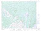
John Reeves Backbone NTS Map Sheets