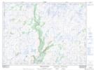
Maps showing Cyrils Hill, Newfoundland and Labrador
Cyrils Hill is a Mountain located in Newfoundland and Labrador.
- Latitude: 47° 47' 4'' North (decimal: 47.7844898)
- Longitude: 57° 11' 7'' West (decimal: -57.1853900)
- Topography Feature Category: Mountain
- Geographical Feature: Hill
- Canadian Province/Territory: Newfoundland and Labrador
- Atlas of Canada Locator Map: Cyrils Hill
- GPS Coordinate Locator Map: Cyrils Hill Lat/Long
Cyrils Hill NTS Map Sheets