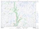
Maps showing Lower Sands, Newfoundland and Labrador
Lower Sands is a River feature located in Newfoundland and Labrador.
- Latitude: 47° 51' 48'' North (decimal: 47.8633298)
- Longitude: 57° 16' 33'' West (decimal: -57.2758398)
- Topography Feature Category: River feature
- Geographical Feature: Pool
- Canadian Province/Territory: Newfoundland and Labrador
- Atlas of Canada Locator Map: Lower Sands
- GPS Coordinate Locator Map: Lower Sands Lat/Long
Lower Sands NTS Map Sheets