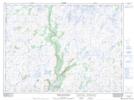
Maps showing Middle Country Path, Newfoundland and Labrador
Middle Country Path is a Forest located in Newfoundland and Labrador.
- Latitude: 47° 46' 50'' North (decimal: 47.7806600)
- Longitude: 57° 15' 8'' West (decimal: -57.2522200)
- Topography Feature Category: Forest
- Geographical Feature: Woods
- Canadian Province/Territory: Newfoundland and Labrador
- Atlas of Canada Locator Map: Middle Country Path
- GPS Coordinate Locator Map: Middle Country Path Lat/Long
Middle Country Path NTS Map Sheets