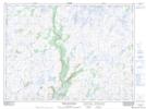
Maps showing Muskrat Mesh, Newfoundland and Labrador
Muskrat Mesh is a Low vegetation located in Newfoundland and Labrador.
- Latitude: 47° 46' 28'' North (decimal: 47.7743098)
- Longitude: 57° 16' 5'' West (decimal: -57.2681798)
- Topography Feature Category: Low vegetation
- Geographical Feature: Marsh
- Canadian Province/Territory: Newfoundland and Labrador
- Atlas of Canada Locator Map: Muskrat Mesh
- GPS Coordinate Locator Map: Muskrat Mesh Lat/Long
Muskrat Mesh NTS Map Sheets