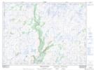
Maps showing Pinks Path, Newfoundland and Labrador
Pinks Path is a Road feature located in Newfoundland and Labrador.
- Latitude: 47° 45' 52'' North (decimal: 47.7644499)
- Longitude: 57° 18' 26'' West (decimal: -57.3072098)
- Topography Feature Category: Road feature
- Geographical Feature: Path
- Canadian Province/Territory: Newfoundland and Labrador
- Atlas of Canada Locator Map: Pinks Path
- GPS Coordinate Locator Map: Pinks Path Lat/Long
Pinks Path NTS Map Sheets