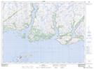
Maps showing Colliers Hill, Newfoundland and Labrador
Colliers Hill is a Mountain located in Newfoundland and Labrador.
- Latitude: 47° 42' 10'' North (decimal: 47.7028296)
- Longitude: 57° 25' 20'' West (decimal: -57.4221096)
- Topography Feature Category: Mountain
- Geographical Feature: Hill
- Canadian Province/Territory: Newfoundland and Labrador
- Atlas of Canada Locator Map: Colliers Hill
- GPS Coordinate Locator Map: Colliers Hill Lat/Long