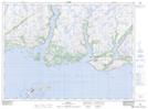
Maps showing Slop Dish, Newfoundland and Labrador
Slop Dish is a Lake located in Newfoundland and Labrador.
- Latitude: 47° 44' 5'' North (decimal: 47.7346298)
- Longitude: 57° 5' 21'' West (decimal: -57.0890996)
- Topography Feature Category: Lake
- Geographical Feature: Pond
- Canadian Province/Territory: Newfoundland and Labrador
- Atlas of Canada Locator Map: Slop Dish
- GPS Coordinate Locator Map: Slop Dish Lat/Long