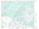
Maps showing Bill Toms Feeder, Newfoundland and Labrador
Bill Toms Feeder is a River located in Newfoundland and Labrador.
- Latitude: 50° 59' 30'' North (decimal: 50.9916699)
- Longitude: 56° 39' 3'' West (decimal: -56.6508299)
- Topography Feature Category: River
- Geographical Feature: Feeder
- Canadian Province/Territory: Newfoundland and Labrador
- Atlas of Canada Locator Map: Bill Toms Feeder
- GPS Coordinate Locator Map: Bill Toms Feeder Lat/Long
Bill Toms Feeder NTS Map Sheets