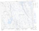
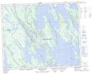
Maps showing Redfir Lake-Kapitagas Channel, Newfoundland and Labrador
Redfir Lake-Kapitagas Channel is a Conservation area located in Newfoundland and Labrador.
- Latitude: 52° 20' 2'' North (decimal: 52.334)
- Longitude: 66° 5' 46'' West (decimal: -66.096)
- Topography Feature Category: Conservation area
- Geographical Feature: Ecological Reserve
- Canadian Province/Territory: Newfoundland and Labrador
- Atlas of Canada Locator Map: Redfir Lake-Kapitagas Channel
- GPS Coordinate Locator Map: Redfir Lake-Kapitagas Channel Lat/Long
Redfir Lake-Kapitagas Channel NTS Map Sheets