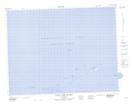
Maps showing Drovers Rock, Newfoundland and Labrador
Drovers Rock is a Shoal located in Newfoundland and Labrador.
- Latitude: 49° 46' 53'' North (decimal: 49.7812700)
- Longitude: 54° 6' 52'' West (decimal: -54.1143900)
- Topography Feature Category: Shoal
- Geographical Feature: Rock
- Canadian Province/Territory: Newfoundland and Labrador
- Atlas of Canada Locator Map: Drovers Rock
- GPS Coordinate Locator Map: Drovers Rock Lat/Long
Drovers Rock NTS Map Sheets