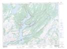
Maps showing Samiajij Miawpukek, Newfoundland and Labrador
Samiajij Miawpukek is a Indian Reserve located in Newfoundland and Labrador.
- Latitude: 47° 52' 00'' North (decimal: 47.8666665)
- Longitude: 55° 44' 37'' West (decimal: -55.7436111)
- Topography Feature Category: Indian Reserve
- Geographical Feature: Indian Reserve - Réserve indienne
- Canadian Province/Territory: Newfoundland and Labrador
- Atlas of Canada Locator Map: Samiajij Miawpukek
- GPS Coordinate Locator Map: Samiajij Miawpukek Lat/Long
Samiajij Miawpukek NTS Map Sheets