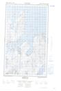
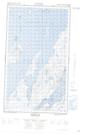
Maps showing Makkovik Pond, Newfoundland and Labrador
Makkovik Pond is a Lake located in Newfoundland and Labrador.
- Latitude: 55° 2' North (decimal: 55.0332998)
- Longitude: 59° 9' West (decimal: -59.1499998)
- Topography Feature Category: Lake
- Geographical Feature: Pond
- Canadian Province/Territory: Newfoundland and Labrador
- Atlas of Canada Locator Map: Makkovik Pond
- GPS Coordinate Locator Map: Makkovik Pond Lat/Long
Makkovik Pond NTS Map Sheets