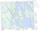
Maps showing Cap du Rocher, Newfoundland and Labrador
Cap du Rocher is a Cape located in Newfoundland and Labrador.
- Latitude: 52° 40' North (decimal: 52.6666998)
- Longitude: 66° 5' West (decimal: -66.0832998)
- Topography Feature Category: Cape
- Geographical Feature: Cap
- Canadian Province/Territory: Newfoundland and Labrador
- Atlas of Canada Locator Map: Cap du Rocher
- GPS Coordinate Locator Map: Cap du Rocher Lat/Long
Cap du Rocher NTS Map Sheets