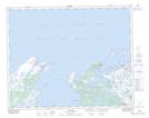
Maps showing Burnt Cape Ecological Reserve, Newfoundland and Labrador
Burnt Cape Ecological Reserve is a Conservation area located in Newfoundland and Labrador.
- Latitude: 51° 34' 23'' North (decimal: 51.573171)
- Longitude: 55° 44' 45'' West (decimal: -55.745972)
- Topography Feature Category: Conservation area
- Geographical Feature: Ecological Reserve
- Canadian Province/Territory: Newfoundland and Labrador
- Atlas of Canada Locator Map: Burnt Cape Ecological Reserve
- GPS Coordinate Locator Map: Burnt Cape Ecological Reserve Lat/Long