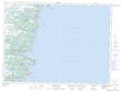
Maps showing Burnt Cove - St. Michaels - Bauline South, Newfoundland and Labrador
Burnt Cove - St. Michaels - Bauline South is a Unincorporated area located in Newfoundland and Labrador.
- Latitude: 47° 11' 35'' North (decimal: 47.1930555)
- Longitude: 52° 50' 42'' West (decimal: -52.8449998)
- Topography Feature Category: Unincorporated area
- Geographical Feature: Local Service District
- Canadian Province/Territory: Newfoundland and Labrador
- Atlas of Canada Locator Map: Burnt Cove - St. Michaels - Bauline South
- GPS Coordinate Locator Map: Burnt Cove - St. Michaels - Bauline South Lat/Long
Burnt Cove - St. Michaels - Bauline South NTS Map Sheets