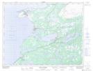
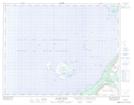
Maps showing Eddird Cove West, Newfoundland and Labrador
Eddird Cove West is a Unincorporated area located in Newfoundland and Labrador.
- Latitude: 50° 44' 54'' North (decimal: 50.7483331)
- Longitude: 57° 10' 21'' West (decimal: -57.1724998)
- Topography Feature Category: Unincorporated area
- Geographical Feature: Local Service District
- Canadian Province/Territory: Newfoundland and Labrador
- Atlas of Canada Locator Map: Eddird Cove West
- GPS Coordinate Locator Map: Eddird Cove West Lat/Long
Eddird Cove West NTS Map Sheets