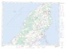
Maps showing O'Brien Road, Prince, Prince Edward Island
O'Brien Road is a Unincorporated area located in Prince, Prince Edward Island.
- Latitude: 46° 49' North (decimal: 46.8166999)
- Longitude: 64° 10' West (decimal: -64.1666999)
- Topography Feature Category: Unincorporated area
- Geographical Feature: Locality
- Canadian Province/Territory: Prince Edward Island
- Location: Prince
- GPS Coordinate Locator Map: O'Brien Road Lat/Long