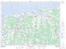
Maps showing Sand Hills, Kings, Prince Edward Island
Sand Hills is a Mountain located in Kings, Prince Edward Island.
- Latitude: 46° 27' North (decimal: 46.4500000)
- Longitude: 62° 43' West (decimal: -62.7167000)
- Topography Feature Category: Mountain
- Geographical Feature: Sand Hills
- Canadian Province/Territory: Prince Edward Island
- Location: Kings
- GPS Coordinate Locator Map: Sand Hills Lat/Long
Sand Hills NTS Map Sheets