Maps showing St. Eleanors, Prince, Prince Edward Island
St. Eleanors is a Unincorporated area located in Prince, Prince Edward Island and has an elevation of 26 meters.
- Latitude: 46° 25' 17'' North (decimal: 46.4213999)
- Longitude: 63° 48' 40'' West (decimal: -63.8110999)
- Topography Feature Category: Unincorporated area
- Geographical Feature: Locality
- Canadian Province/Territory: Prince Edward Island
- Elevation: 26 meters
- Location: Prince
- Atlas of Canada Locator Map: St. Eleanors
- GPS Coordinate Locator Map: St. Eleanors Lat/Long
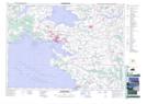
St. Eleanors NTS Map Sheets