Maps showing Queens, Prince Edward Island
Queens is a Geographical area located in Prince Edward Island.
- Latitude: 46° 17' North (decimal: 46.2832999)
- Longitude: 63° 15' West (decimal: -63.2499999)
- Topography Feature Category: Geographical area
- Geographical Feature: County
- Canadian Province/Territory: Prince Edward Island
- Atlas of Canada Locator Map: Queens
- GPS Coordinate Locator Map: Queens Lat/Long
Queens NTS Map Sheets
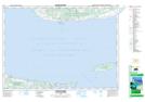
011E15 Pictou Island Topographic Map at 1:50,000 scale
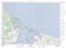
011L02 Montague Topographic Map at 1:50,000 scale
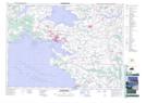
011L03 Charlottetown Topographic Map at 1:50,000 scale
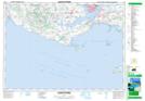
011L04 Cape Tormentine Topographic Map at 1:50,000 scale
011L05 Summerside Topographic Map at 1:50,000 scale
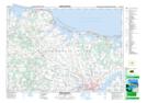
011L06 North Rustico Topographic Map at 1:50,000 scale
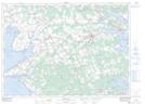
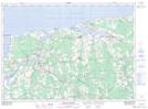
011L07 Mount Stewart Topographic Map at 1:50,000 scale
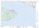
011L12 Malpeque Topographic Map at 1:50,000 scale
011E Truro Topographic Map at 1:250,000 scale
011L Charlottetown Topographic Map at 1:250,000 scale