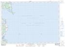
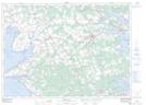
Maps showing St. Marys Bay, Kings, Prince Edward Island
St. Marys Bay is a Bay located in Kings, Prince Edward Island and has an elevation of 0 meters.
- Latitude: 46° 7' North (decimal: 46.1167000)
- Longitude: 62° 29' West (decimal: -62.4832999)
- Topography Feature Category: Bay
- Geographical Feature: Bay
- Canadian Province/Territory: Prince Edward Island
- Elevation: 0 meters
- Location: Kings
- Atlas of Canada Locator Map: St. Marys Bay
- GPS Coordinate Locator Map: St. Marys Bay Lat/Long
St. Marys Bay NTS Map Sheets