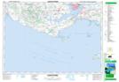
Maps showing Argyle Provincial Park, Queens, Prince Edward Island
Argyle Provincial Park is a Conservation area located in Queens, Prince Edward Island.
- Latitude: 46° 10' North (decimal: 46.1666999)
- Longitude: 63° 23' West (decimal: -63.3832999)
- Topography Feature Category: Conservation area
- Geographical Feature: Provincial Park
- Canadian Province/Territory: Prince Edward Island
- Location: Queens
- Atlas of Canada Locator Map: Argyle Provincial Park
- GPS Coordinate Locator Map: Argyle Provincial Park Lat/Long
Argyle Provincial Park NTS Map Sheets