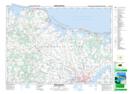
Maps showing Oysterbed Bridge, Prince Edward Island
Oysterbed Bridge is a Unincorporated area located in Prince Edward Island.
- Latitude: 46° 23' North (decimal: 46.3833000)
- Longitude: 63° 14' West (decimal: -63.2333000)
- Topography Feature Category: Unincorporated area
- Geographical Feature: Settlement
- Canadian Province/Territory: Prince Edward Island
- GPS Coordinate Locator Map: Oysterbed Bridge Lat/Long
Oysterbed Bridge NTS Map Sheets