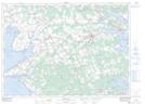
Maps showing Macphee Beach, Prince Edward Island
Macphee Beach is a Beach located in Prince Edward Island.
- Latitude: 46° 12' North (decimal: 46.2000000)
- Longitude: 62° 31' West (decimal: -62.5167000)
- Topography Feature Category: Beach
- Geographical Feature: Beach
- Canadian Province/Territory: Prince Edward Island
- GPS Coordinate Locator Map: Macphee Beach Lat/Long
Macphee Beach NTS Map Sheets