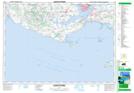
Maps showing Alexandra Point Range, Queens, Prince Edward Island
Alexandra Point Range is a Military area located in Queens, Prince Edward Island.
- Latitude: 46° 11' 25'' North (decimal: 46.1903000)
- Longitude: 63° 3' 00'' West (decimal: -63.0499999)
- Topography Feature Category: Military area
- Geographical Feature: C.F.T.A.
- Canadian Province/Territory: Prince Edward Island
- Location: Queens
- Atlas of Canada Locator Map: Alexandra Point Range
- GPS Coordinate Locator Map: Alexandra Point Range Lat/Long
Alexandra Point Range NTS Map Sheets