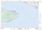
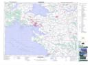
Maps showing Borden-Carleton, Prince, Prince Edward Island
Borden-Carleton is a Village located in Prince, Prince Edward Island.
- Latitude: 46° 15' 42'' North (decimal: 46.2617000)
- Longitude: 63° 40' 26'' West (decimal: -63.6738999)
- Topography Feature Category: Village
- Geographical Feature: Community
- Canadian Province/Territory: Prince Edward Island
- Location: Prince
- Atlas of Canada Locator Map: Borden-Carleton
- GPS Coordinate Locator Map: Borden-Carleton Lat/Long
Borden-Carleton NTS Map Sheets