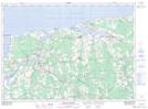
Maps showing Morell 2, Kings, Prince Edward Island
Morell 2 is a Indian Reserve located in Kings, Prince Edward Island.
- Latitude: 46° 22' 18'' North (decimal: 46.3716668)
- Longitude: 62° 42' 32'' West (decimal: -62.7088889)
- Topography Feature Category: Indian Reserve
- Geographical Feature: Indian Reserve - Réserve indienne
- Canadian Province/Territory: Prince Edward Island
- Location: Kings
- Atlas of Canada Locator Map: Morell 2
- GPS Coordinate Locator Map: Morell 2 Lat/Long
Morell 2 NTS Map Sheets