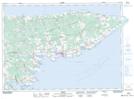
Maps showing Refuge d'oiseaux de Black Pond, Prince Edward Island
Refuge d'oiseaux de Black Pond is a Conservation area located in Prince Edward Island and has an elevation of 7 meters.
- Latitude: 46° 22' 30'' North (decimal: 46.3749999)
- Longitude: 62° 10' 00'' West (decimal: -62.1666666)
- Topography Feature Category: Conservation area
- Geographical Feature: Refuge d'oiseaux migrateurs
- Canadian Province/Territory: Prince Edward Island
- Elevation: 7 meters
- Atlas of Canada Locator Map: Refuge d'oiseaux de Black Pond
- GPS Coordinate Locator Map: Refuge d'oiseaux de Black Pond Lat/Long
Refuge d'oiseaux de Black Pond NTS Map Sheets