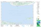
Maps showing MacPhersons Creek, Queens, Prince Edward Island
MacPhersons Creek is a River located in Queens, Prince Edward Island.
- Latitude: 45° 58' North (decimal: 45.9666668)
- Longitude: 62° 40' West (decimal: -62.6666670)
- Topography Feature Category: River
- Geographical Feature: Creek
- Canadian Province/Territory: Prince Edward Island
- Location: Queens
- Atlas of Canada Locator Map: MacPhersons Creek
- GPS Coordinate Locator Map: MacPhersons Creek Lat/Long
MacPhersons Creek NTS Map Sheets