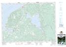
Maps showing Alpine Ridge, Inverness, Nova Scotia
Alpine Ridge is a Unincorporated area located in Inverness, Nova Scotia.
- Latitude: 46° 0' 56'' North (decimal: 46.0155555)
- Longitude: 61° 24' 36'' West (decimal: -61.4099999)
- Topography Feature Category: Unincorporated area
- Geographical Feature: Locality
- Canadian Province/Territory: Nova Scotia
- Location: Inverness
- Atlas of Canada Locator Map: Alpine Ridge
- GPS Coordinate Locator Map: Alpine Ridge Lat/Long
Alpine Ridge NTS Map Sheets