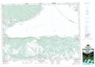
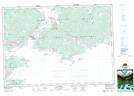
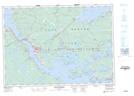
Maps showing Arichat Harbour, Richmond, Nova Scotia
Arichat Harbour is a Bay located in Richmond, Nova Scotia and has an elevation of 16 meters.
- Latitude: 45° 30' 28'' North (decimal: 45.5077777)
- Longitude: 61° 0' 50'' West (decimal: -61.0138888)
- Topography Feature Category: Bay
- Geographical Feature: Harbour
- Canadian Province/Territory: Nova Scotia
- Elevation: 16 meters
- Location: Richmond
- Atlas of Canada Locator Map: Arichat Harbour
- GPS Coordinate Locator Map: Arichat Harbour Lat/Long
Arichat Harbour NTS Map Sheets