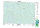
Maps showing Auger Lake, Shelburne; Yarmouth, Nova Scotia
Auger Lake is a Lake located in Shelburne; Yarmouth, Nova Scotia and has an elevation of 80 meters.
- Latitude: 44° 0' 43'' North (decimal: 44.0119444)
- Longitude: 65° 30' 26'' West (decimal: -65.5072222)
- Topography Feature Category: Lake
- Geographical Feature: Lake
- Canadian Province/Territory: Nova Scotia
- Elevation: 80 meters
- Location: Shelburne; Yarmouth
- Atlas of Canada Locator Map: Auger Lake
- GPS Coordinate Locator Map: Auger Lake Lat/Long
Auger Lake NTS Map Sheets