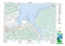
Maps showing Avondale, Hants, Nova Scotia
Avondale is a Unincorporated area located in Hants, Nova Scotia and has an elevation of 26 meters.
- Latitude: 45° 1' 22'' North (decimal: 45.0227777)
- Longitude: 64° 7' 25'' West (decimal: -64.1236111)
- Topography Feature Category: Unincorporated area
- Geographical Feature: Community
- Canadian Province/Territory: Nova Scotia
- Elevation: 26 meters
- Location: Hants
- Atlas of Canada Locator Map: Avondale
- GPS Coordinate Locator Map: Avondale Lat/Long