Maps showing Basin Falls, Shelburne, Nova Scotia
Basin Falls is a Falls located in Shelburne, Nova Scotia.
- Latitude: 43° 52' North (decimal: 43.8666666)
- Longitude: 65° 24' West (decimal: -65.3991666)
- Topography Feature Category: Falls
- Geographical Feature: Falls
- Canadian Province/Territory: Nova Scotia
- Location: Shelburne
- Atlas of Canada Locator Map: Basin Falls
- GPS Coordinate Locator Map: Basin Falls Lat/Long
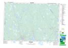
Basin Falls NTS Map Sheets