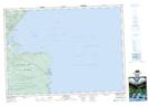
Maps showing Bay Road Valley, Victoria, Nova Scotia
Bay Road Valley is a Unincorporated area located in Victoria, Nova Scotia and has an elevation of 174 meters.
- Latitude: 46° 58' 11'' North (decimal: 46.9697222)
- Longitude: 60° 28' 22'' West (decimal: -60.4727777)
- Topography Feature Category: Unincorporated area
- Geographical Feature: Community
- Canadian Province/Territory: Nova Scotia
- Elevation: 174 meters
- Location: Victoria
- Atlas of Canada Locator Map: Bay Road Valley
- GPS Coordinate Locator Map: Bay Road Valley Lat/Long