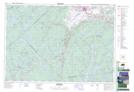
Maps showing Benjamins Mill, Hants, Nova Scotia
Benjamins Mill is a Unincorporated area located in Hants, Nova Scotia.
- Latitude: 44° 55' 38'' North (decimal: 44.9272222)
- Longitude: 64° 18' 31'' West (decimal: -64.3086111)
- Topography Feature Category: Unincorporated area
- Geographical Feature: Locality
- Canadian Province/Territory: Nova Scotia
- Location: Hants
- Atlas of Canada Locator Map: Benjamins Mill
- GPS Coordinate Locator Map: Benjamins Mill Lat/Long
Benjamins Mill NTS Map Sheets