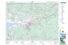
Maps showing Bible Hill, Colchester, Nova Scotia
Bible Hill is a Village located in Colchester, Nova Scotia and has an elevation of 29 meters.
- Latitude: 45° 22' 32'' North (decimal: 45.3755555)
- Longitude: 63° 15' 37'' West (decimal: -63.2602777)
- Topography Feature Category: Village
- Geographical Feature: Village
- Canadian Province/Territory: Nova Scotia
- Elevation: 29 meters
- Location: Colchester
- Atlas of Canada Locator Map: Bible Hill
- GPS Coordinate Locator Map: Bible Hill Lat/Long