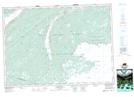
Maps showing Big Island Lake, Cape Breton, Nova Scotia
Big Island Lake is a Lake located in Cape Breton, Nova Scotia and has an elevation of 89 meters.
- Latitude: 45° 47' 23'' North (decimal: 45.7897222)
- Longitude: 60° 27' 51'' West (decimal: -60.4641666)
- Topography Feature Category: Lake
- Geographical Feature: Lake
- Canadian Province/Territory: Nova Scotia
- Elevation: 89 meters
- Location: Cape Breton
- Atlas of Canada Locator Map: Big Island Lake
- GPS Coordinate Locator Map: Big Island Lake Lat/Long