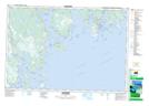
Maps showing Birchtown, Shelburne, Nova Scotia
Birchtown is a Unincorporated area located in Shelburne, Nova Scotia and has an elevation of 8 meters.
- Latitude: 43° 44' 40'' North (decimal: 43.7444444)
- Longitude: 65° 23' 00'' West (decimal: -65.3833333)
- Topography Feature Category: Unincorporated area
- Geographical Feature: Community
- Canadian Province/Territory: Nova Scotia
- Elevation: 8 meters
- Location: Shelburne
- Atlas of Canada Locator Map: Birchtown
- GPS Coordinate Locator Map: Birchtown Lat/Long
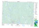
Birchtown NTS Map Sheets