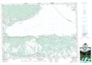
Maps showing Birchtown Lake, Guysborough, Nova Scotia
Birchtown Lake is a Lake located in Guysborough, Nova Scotia and has an elevation of 110 meters.
- Latitude: 45° 28' 52'' North (decimal: 45.4811111)
- Longitude: 61° 27' 42'' West (decimal: -61.4616666)
- Topography Feature Category: Lake
- Geographical Feature: Lake
- Canadian Province/Territory: Nova Scotia
- Elevation: 110 meters
- Location: Guysborough
- Atlas of Canada Locator Map: Birchtown Lake
- GPS Coordinate Locator Map: Birchtown Lake Lat/Long
Birchtown Lake NTS Map Sheets