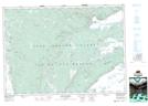
Maps showing Blues Mills, Inverness, Nova Scotia
Blues Mills is a Unincorporated area located in Inverness, Nova Scotia and has an elevation of 68 meters.
- Latitude: 45° 55' 27'' North (decimal: 45.9241666)
- Longitude: 61° 11' 56'' West (decimal: -61.1988888)
- Topography Feature Category: Unincorporated area
- Geographical Feature: Community
- Canadian Province/Territory: Nova Scotia
- Elevation: 68 meters
- Location: Inverness
- Atlas of Canada Locator Map: Blues Mills
- GPS Coordinate Locator Map: Blues Mills Lat/Long