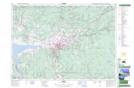
Maps showing Camden, Colchester, Nova Scotia
Camden is a Unincorporated area located in Colchester, Nova Scotia and has an elevation of 182 meters.
- Latitude: 45° 18' 51'' North (decimal: 45.3141666)
- Longitude: 63° 11' 35'' West (decimal: -63.1930555)
- Topography Feature Category: Unincorporated area
- Geographical Feature: Dispersed Rural Community
- Canadian Province/Territory: Nova Scotia
- Elevation: 182 meters
- Location: Colchester
- Atlas of Canada Locator Map: Camden
- GPS Coordinate Locator Map: Camden Lat/Long