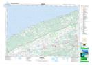
Maps showing Campbell Meadows, Kings, Nova Scotia
Campbell Meadows is a Low vegetation located in Kings, Nova Scotia and has an elevation of 26 meters.
- Latitude: 45° 1' North (decimal: 45.0166666)
- Longitude: 64° 53' West (decimal: -64.8824999)
- Topography Feature Category: Low vegetation
- Geographical Feature: Meadows
- Canadian Province/Territory: Nova Scotia
- Elevation: 26 meters
- Location: Kings
- Atlas of Canada Locator Map: Campbell Meadows
- GPS Coordinate Locator Map: Campbell Meadows Lat/Long